
条条大路通罗马,罗马的道路怎样呢?
The legacy of the Roman Empire can today be seen from space.Satellite images show lights from prospering towns surrounding Roman roads that were built 2,000 years ago. In a new study, researchers have confirmed that these Roman roads still act as a hot bed for economic growth and activity, much in the same way they did almost two millennia ago.
Researchers from the universities of Copenhagen studied Roman roads from AD117 using satellite images and the Digital Atlas. They looked at population density and the intensity of lights at night along 50,000 miles of Roman roads. By AD117, Romans had built roads across most of the continent from Hadrian's wall down to parts of the Middle East. The Romans mostly built the roads in newly conquered undeveloped regions to establish strong trade routes. They built their roads to be very straight on purpose to make the journey time as short as possible.
In their study, the scientists found that Roman road density was linked to greater economic activity in 2010. “There does seem to be a link between the location of ancient roads and economic activity today, ”they said. The connection, however, was not as strong in north Africa due to a move from wheeled transport to camel caravans.
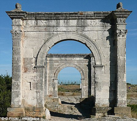
Today, preservation of Roman roads across the world varies. In Britain, some are still easily visible. Famous Roman roads include Watling Street, which ran from London to Chester, and the Fosse Way, which crossed from Exeter to Lincoln.
Because Roman roads are so well-built and extensive, they can be easily seen and found from space. That is exactly what Shane Kimbrough did in 2017. Kimbrough took a series of images while flying 250 miles over Earth from the International Space Station that showed the Earth at night with lights showing the busy towns and cities.
本时文内容由奇速英语国际教育研究院原创编写,未经书面授权,禁止复制和任何商业用途,版权所有,侵权必究!(投稿及合作联系:028-84400718 QQ:757722345)
1.“The legacy of the Roman Empire” in the first paragraph may refer to _______.
A satellite images
B prospering towns
C Roman roads
D Copenhagen researchers
解析:选C。词义猜测题。根据文章第一段第二句的lights from prospering towns surrounding Roman roads that were built 2,000 years ago可以得知古罗马的遗产是指“古罗马的道路”。故选C。
2.What purpose did the ancient Romans build the roads?
A They wanted to conquer undeveloped regions.
B They needed to travel parts of the Middle East.
C They were able to do business with other people.
D They had to travel fast to fight with their enemy.
解析:选C。推理判断题。根据第二段第四句的The Romans mostly built the roads in newly conquered undeveloped regions to establish strong trade routes可以得知古罗马修路的目的是为了贸易,也就是说是为了“做生意”。故选C。
3.Why isn’t Roman road density linked strongly with economy in north Africa?
A People there had different ways of traveling.
B Romans had less economic activity there.
C They used satellites and the Digital Atlas.
D The location of ancient roads was gone.
解析:选A。推理判断题。根据第三段最后一句的The connection, however, was not as strong in north Africa due to a move from wheeled transport to camel caravans可以得知是因为交通方式的改变才导致了在北非的古罗马的道路和经济活动的关系不是很密切。故选A。
4.Where can people walk on the ancient Roman roads?
A In China.
B In the UK.
C In the space station.
D In the far East.
解析:选B。细节理解题。根据第四段第二、三句的In Britain, some are still easily visible. Famous Roman roads include Watling Street可以得知在英国能够发现古罗马的道路。故选B。